It should be obvious that weather and light are important aspects of landscape photography. No matter where you are, it pays to keep an eye on the weather, and to learn local weather patterns.
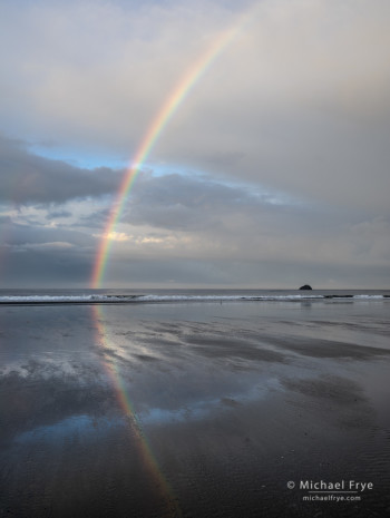
We arrived in Crescent City about five days before our redwoods workshop was set to begin. Our first night there some showers moved through, and at sunrise it was gray and raining. But online radar and satellite images showed that the showers might end soon, so I prepared to go out. Then through our hotel room window I saw a rainbow! We made a dash for the car, drove out to Crescent Beach, and luckily the rainbow was still there (right).
The weather then settled into a more typical pattern for the season, with frequent coastal fog and low clouds in the mornings, giving way to clear skies in the afternoons. This pattern should be familiar to anyone who has spent time along the California coast in summer.
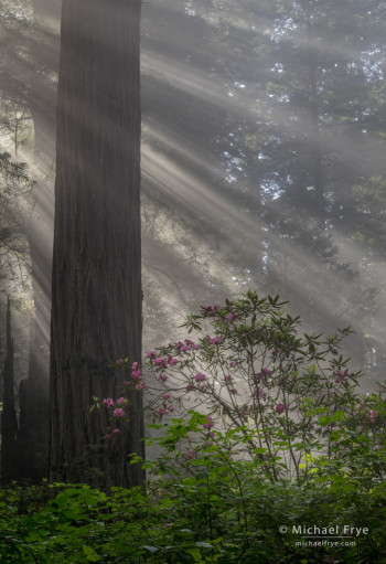
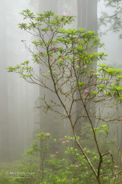
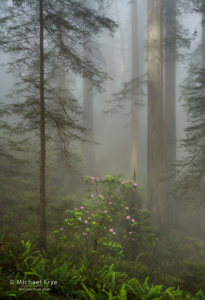
This fog is the perfect complement to redwood forests. The rhododendrons were also putting on a great display this year, so for the first part of our workshop, and while scouting beforehand, we had beautiful conditions in the redwoods, with fog, rhododendrons, and even sunbeams.
But on the last day of the workshop the wind shifted and pushed the coastal fog offshore. This also happens frequently along the northern California coast, even in summer, as any disturbance in the weather pattern can change the winds and move the fog out to sea. But the offshore wind produced a different kind of fog – valley fog along the Klamath River. I didn’t think we would see valley fog during this visit, because valley fog usually requires damp ground from recent rains, and there hadn’t been much rain in the area. But apparently the river itself provided enough moisture to create fog.
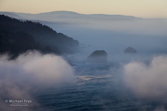
This time the fog flowed along the river toward the sea, and it was local enough, and low enough, for us to get above it near the mouth of the Klamath River. It was a special treat to look out over the fog bank, and then to watch and photograph the sun breaking through the fog and lighting the surf.
This little story about the weather doesn’t have a profound point to it. But it does emphasize, once again, how important weather is to landscape photography. The more time you spend in an area, and the more you pay attention to the local weather patterns, the better your odds of predicting the weather and being in the right place at the right time.
Of course meteorologists are paid to predict the weather, and the forecasts they produce can help – if you can find the right forecast. People often ask me what apps I use for the weather, and the answer is that I usually don’t use any. Unfortunately, many of the smartphone weather apps seem to use the forecast for the nearest city, which isn’t helpful for remote areas. For example, if you look for a forecast for Yosemite, some of the smartphone apps will actually give you the forecast for Merced, which is 60 miles away and 4,000 feet lower. Not very useful.
I’ve found that I get the best, most accurate forecasts for rural areas from the National Weather Service website. The main forecasts from the National Weather Service, like this one from Crescent City, are pretty basic. But if you dig a little deeper you can get more detail. Toward the bottom of the screen, under “Additional Forecasts and Information,” the Forecast Discussion goes into more detail about what the forecasters are thinking, though reading it requires wading through some jargon. Next to the Forecast Discussion is the Hourly Weather Graph, which provides hour-by-hour predictions for cloud cover, precipitation, wind, etc.
Of course any forecast is an attempt to predict the future, and no matter how good the computer models get, that’s an impossible task. While short-term forecasts can be somewhat useful, long-term forecasts should be treated with skepticism. And forecasters are mainly trying to make predictions that are good enough for the general public, but they often don’t provide enough detail for photographers. Most people don’t need to know whether a storm will clear before sunset or not, but we do. And fog is always rather unpredictable, so forecasters tend to use very general terms, while we need to know whether there’s going to be fog at a specific place at a specific time.
All of which means that there’s no substitute for using your eyes. The more you pay attention to local weather patterns, the better you’ll get at making your own short-term predictions. And you can supplement what you see out the window with animated satellite and radar images. That morning in Crescent City, for example, if I had just woken up and looked out the window I might have seen the gray skies and falling rain and gone back to bed. But the radar and satellite images told me that the rain would end soon, and skies might clear, so I should get ready.
Here’s where I do use an app, the Intellicast weather app, which has good animated radar and satellite images, and even a somewhat-useful “Future Radar” feature. I actually prefer Intellicast’s radar images, both in the app and on their website, to those from the National Weather Service, but for satellite images the National Weather Services’s visible and infrared photos give more detail. I can actually see coastal fog on the visible satellite, and sometimes even make out fog at night on the infrared satellite images.
All of this gets a bit geeky. If you’ve never looked at online satellite or radar images before, you might find it hard to interpret what you’re seeing. But with a little practice it gets easier, and the payoff can be great. Having an idea of what the weather might do an hour in advance, or even five minutes in advance, can make the difference between catching some fantastic light or just missing it.
— Michael Frye
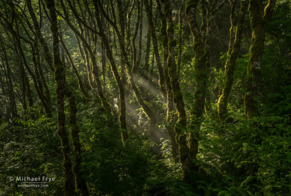
Alders and sunbeams, Redwood NP. After the rain, the sun evaporated moisture from these alders, creating very localized fog and sunbeams.
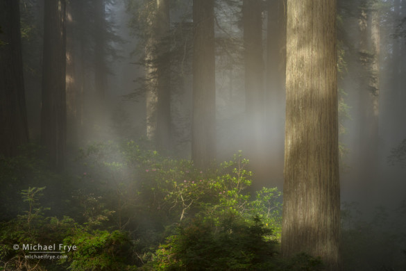
Redwoods, rhododendrons, and a fog rainbow. You can actually see a hint of color in the “fogbow” just right of center.
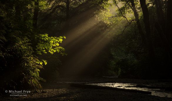
Sunbeams at the mouth of Fern Canyon. There was no fog when we found this scene, but sometimes there’s enough moisture and haze coming off the ocean to create sunbeams with the light at the right angle.
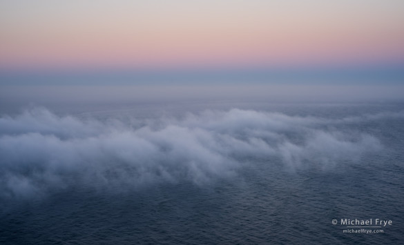
Fog over the Pacific Ocean, flowing from the mouth of the Klamath River, on the last day of our workshop
Related Posts: Rainbow Weather; Courting Luck: How to Take Advantage of Special Light and Weather in Landscape Photography; Waves and Slow Shutter Speeds
Did you like this article? Click here to subscribe to this blog and get every new post delivered right to your inbox!
Michael Frye is a professional photographer specializing in landscapes and nature. He is the author or principal photographer of The Photographer’s Guide to Yosemite, Yosemite Meditations, Yosemite Meditations for Women, and Digital Landscape Photography: In the Footsteps of Ansel Adams and the Great Masters. He has also written three eBooks: Light & Land: Landscapes in the Digital Darkroom, Exposure for Outdoor Photography, and Landscapes in Lightroom 5: The Essential Step-by-Step Guide. Michael written numerous magazine articles on the art and technique of photography, and his images have been published in over thirty countries around the world. Michael has lived either in or near Yosemite National Park since 1983, currently residing just outside the park in Mariposa, California.



I can confirm it’s definitely worth while. I’m using MyCast from Garmin (it covers part of Europe and Italy, fortunately the parts I’m mostly interested into) and radar maps work. I’ve already been able to roughly “predict” the next hours of showers, drive around them, search for the possibility of rainbows, and understand that the sun was going to show up before the end of day, with interesting light.
BTW, your photos are fantastic, as usual.
Thanks Fabrizio! There are a lot of apps that have animated radar images, but very few that have animated satellite photos, which I think are just as important, if not more important, for photographers. You can’t have rain without clouds, but you can certainly have clouds – lots of clouds – without rain.
Great post, info, and super stunning photos! You really used the fog and light perfectly! 🙂
Thank you Rachel!
Me encanta lo que haces, veo cada fotografía que publicas con pasión, me gustaría tanto estar en tu lugar pero no me es posible por muchos motivos, sobretodo la capacitación, felicitaciones, hermoso, hermoso…..
Thank you Ida!
Fantastic selection of photos. I couldn’t tell you which one I like the most.
Thanks Kevin!
There is so much to good photography besides pressing a few buttons. Thanks for getting us to the right places at the right times during the workshop by using your knowledge of light, the area and it’s weather patterns. Your images above are awesome. I’m envious.
Thanks Carol, and there’s no reason to be envious, as the images I saw of yours looked very good. Besides, it’s all a journey, and to me what’s important is learning, getting better, and having fun with it.
We are going to the Redwoods in July and thinking about renting a few pieces of equipment online to try out. What would you recommend for body and lenses for this area. Great photos by the way!
Maria, there’s no special equipment required to photograph redwoods. Just like anywhere else, you’ll want a variety of lenses from wide angle to telephoto. Glad you like the photos!