In the Moment:
Michael Frye's Landscape Photography Blog
by Michael Frye | Jun 7, 2010 | Yosemite Photo Conditions
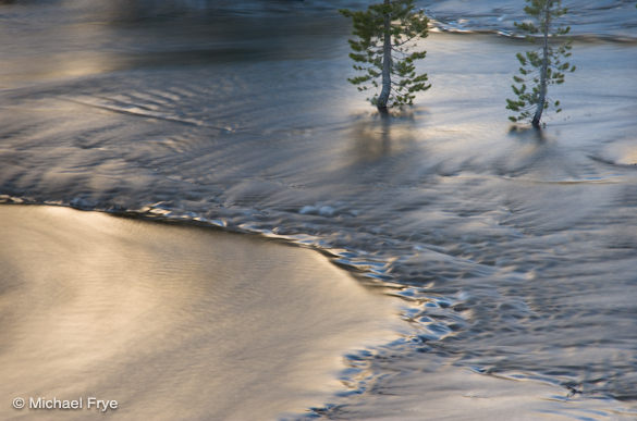
Flooded lodgepole pines along Tenaya Creek
My wife Claudia and I drove over Tioga Pass on Saturday, the first day the road was open this year. There’s a lot of snow up there! Patches of bare ground were scarce, and in some places the snow was still five or six feet deep. Tenaya, Tioga, and Ellery Lakes were still mostly frozen.
We arrived at our home-away-from-home, Murphey’s Motel in Lee Vining, at about 4 p.m. Around seven o’clock, as we drove back over the pass for some photography, we noticed that a large avalanche had covered part of a snow basin just east of Ellery Lake. We had both looked at that slope three hours earlier, and hadn’t seen evidence of an avalanche, so it had apparently fallen within that time.
All the snow was melting fast, and water was everywhere. I saw waterfalls I don’t remember seeing before, and innumerable creeks, streams, and ponds. Just above Tenaya Lake I found a spot where swollen Tenaya Creek had enveloped a stand of lodgepole pines, with the water reflecting a sunlit ridge above.
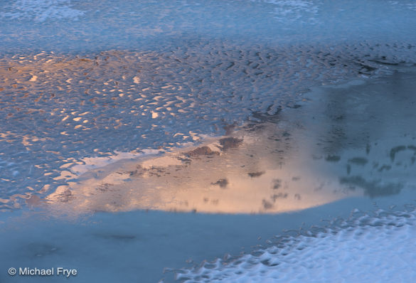
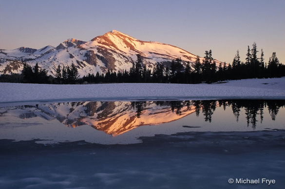
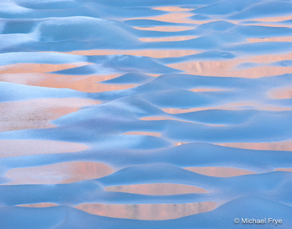
The next morning we rose early and drove up to Tioga Lake, where I photographed snowy peaks reflected in the partially frozen lake, and wonderful ice patterns near the shore. Of course I got too near the edge and received a boot full of water when one of my feet broke through the ice to the lake below.
With the opening of this road the Yosemite high country will be more easily accessible throughout the summer and fall, providing access to many great photo locations. But the snow and ice won’t last long.
We didn’t get into Yosemite Valley, but I’m sure it’s beautiful, with the waterfalls roaring and the meadows flooded. Did any of you make it into the valley this weekend?
Gaylor Peak reflected in Tioga Lake
by Michael Frye | Jun 4, 2010 | Yosemite Photo Conditions
Mammoth Peak from near Tioga Pass
Tioga Pass is scheduled to open tomorrow morning at 8 a.m. When it does, there should be lots of snow at higher elevations, creating some great opportunities to photograph snowy peaks and icy lakes.
The Glacier Point Road opened last Saturday, providing access to some of Yosemite’s best views, and the some of the prettiest meadows in Yosemite, like Summit, McGurk, and Westfall. These meadows should be sprouting corn lilies, which I wrote about on my other blog.
The National Weather Service has issued a flood watch for Yosemite Valley. They’re expecting the Merced River to crest above flood stage on Sunday and Monday mornings, and possibly Tuesday as well. This minor flooding shouldn’t impact travel, but means that the waterfalls will be roaring, and meadows will be partially flooded, creating nice reflecting ponds everywhere.
You can still find dogwoods blooming in Yosemite Valley, although they’re rather ragged. Although I haven’t had a chance to check them, the dogwoods at higher elevations should still be in good shape. My favorite place to photograph dogwoods outside the valley is in the Tuolumne Grove, where you can find them blooming next to giant sequoias.
Speaking of the high country, a space has opened up in my Hidden Yosemite workshop in July. This has always been a really fun class, featuring short hikes to some of the best locations near Tenaya Lake, Tioga Pass, Tuolumne Meadows. Click here for more information.
Melting Ice near Middle Gaylor Lake
by Michael Frye | Apr 25, 2010 | Advanced Techniques, Photography Tips
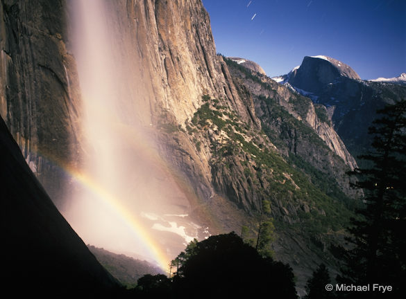
Half Dome and Upper Yosemite Fall with a lunar rainbow
In Friday’s post on my other blog I described some of my experiences attempting to photograph lunar rainbows, but here are some tips for capturing your own moonbow images.
The moon will become full at 5:19 Wednesday morning, so Tuesday night will provide the brightest moonlight, and the best chance to photograph a lunar rainbow this month—if the weather cooperates. Unfortunately the forecast calls for rain. If the predictions are faulty, and some moonlight manages to break through the clouds, cool temperatures will probably limit the amount of spray on Upper Yosemite Fall, so Lower Yosemite Fall may work better. For the upper fall, you might be better off waiting for the next full moon on May 27th. For detailed information on times and places to photograph lunar rainbows in Yosemite, see Don Olson’s site.
For those who aspire to capture lunar rainbows, here are some tips.
Equipment
Any digital SLR will work, but full-frame sensors usually produce less noise and work better for the long exposures required at night. A sturdy tripod is essential, plus a locking cable release or electronic release. You’ll want a good flashlight or headlamp, a watch to time long exposures, and a cloth for wiping spray off the lens if you’re at the lower fall. Long exposures drain batteries quickly, so make sure your camera battery is fully charged—and your spare too.
Focus and Depth of Field
To make exposure times reasonably short, you’ll have to keep your aperture wide open, or close to it. That means you won’t get much depth of field, so try to exclude foregrounds from your compositions. This shallow depth of field makes focusing critical. It’s obviously difficult to focus manually in the dark, and autofocus won’t work either. In the past I’d just manually set the lens at infinity, but many lenses now focus past infinity, making the correct focusing point difficult to determine. The solution is to find something distant that’s bright enough to focus on, like the moon itself, car headlights, or perhaps a bright light that you place far away. Then focus on that bright spot, using either manual or autofocus. The most precise method is probably focusing manually during a zoomed-in look in live view. Once you’ve set the focus, turn autofocus off and don’t touch the focusing ring—leave the lens set at this distance for all your images. You might even tape the focusing ring so it doesn’t move. (more…)
by Michael Frye | Apr 16, 2010 | Yosemite Photo Conditions
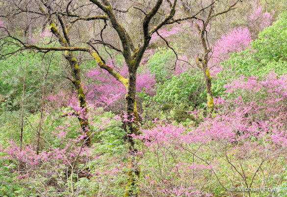
Redbud and oaks, spring 2007
The redbud in the Merced River Canyon are a bit past peak, with many starting to leaf out, but at least half are still in prime condition, so good photographs of them can still be made for at least the next few days. Meanwhile in Yosemite Valley the deciduous trees have buds but no new leaves. The April snowstorms have delayed the appearance of the vivid green leaves of the cottonwoods, alders, maples, and oaks. I expect we might see that green around the end of the month. The dogwoods will probably also be late; while they typically start blooming around the end of April, they might blossom a week or two later this year.
by Michael Frye | Feb 1, 2010 | Yosemite Photo Conditions
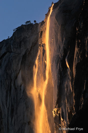
It’s February, so Horsetail Fall season has nearly arrived. Herds of photographers will soon be standing tripod-to-tripod hoping to catch that magical neon glow on this ephemeral slice of water.
Conditions have to be just right to capture a classic Horsetail Fall image: Sufficient water has to be flowing, and the skies need to be clear in the west to allow the setting sun to light the waterfall. It looks like the first condition will be met, as there’s plenty of snow on top of El Capitan to feed Horsetail. How clear the skies will be is anybody’s guess at this point. The ideal scenario would be a stretch of warm clear days during the peak window of light, but that seems unlikely in this El Niño winter.
About that peak window: I posted an article on my website last year describing how I used the Yosemite Association’s web cam to determine the optimum window of light for Horsetail Fall. My conclusion was that the peak day occurred about 60 days after the winter solstice, with the best light stretching from about seven days before that to three days after that. I’ve since learned that the earth wobbles a bit in its orbit, so the sun doesn’t set at exactly the same angle 60 days before the solstice as it does 60 days after the solstice. So I now use the angle — the azimuth — of the setting sun as the best way of determining when the peak day will be. This year February 18th comes closest to the ideal angle, with the window of best light stretching from about February 11th through February 21st.
There are basically two good spots to photograph Horsetail: near the El Capitan picnic area along Northside Drive, and along Southside Drive about .8 miles east of the Cathedral Beach picnic area. I prefer being near the El Capitan picnic area, but both locations have their virtues.
Many people have asked me if I’ll be doing one-day Horsetail Fall workshops again this year with The Ansel Adams Gallery, but I’ll be attending the North American Nature Photography Association’s (NANPA) Summit in Reno from February 16-19, so I’ll miss most of the Horsetail Fall craziness. The Gallery will be hosting a couple of afternoon photo classes with their staff photographers during that time, and if conditions are right they will lead their groups to good spots for Horsetail Fall.
Even though I might miss out, I hope we get some clear sunsets between February 11th and 21st, as that would make many other photographers happy! Good luck to all of you with Horsetail aspirations this year.

